The GeoMaps Extract Tool allows you to download different datasets in a selected area.
Whakamahia te Pūrere Tango Raraunga kei GeoMaps Use the Data Extract Tool in GeoMaps
How to download data in GeoMaps
Step 1: Enter the address in the Search and Find toolbar, or zoom in on the area of interest.
Step 2: Click on the Extract Tool
Step 3: Define the download area on the map (the maximum area you can define is 6km2).
Define the download area by drawing a polygon
Define the download area as what is on the screen
Clear your selection
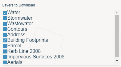
Step 4: Select the layers you want to download.
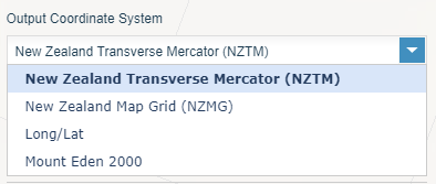
Step 5: Choose your desired Coordinate System.
Step 6: Choose the output format (Options change depending on what layer you have chosen).
For features:
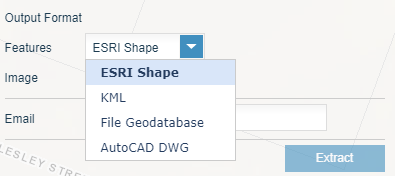
For images:
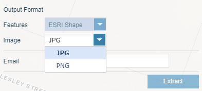
Step 7: Provide your email address.
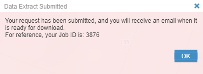
Step 8: Click the extract button. An email will be sent when it is ready for download.